


From Mountains
To Valleys
There are three main designations that make up the county. On the western edge we have the Manti-La Sal forest, in the middle is the San Rafael Swell, and on the Eastside is the Colorado Plateau, a vast landscape that drifts up to the Book Cliffs that run along the northeastern edge.
Explore below to learn more about each of these impressive and unique natural landscapes.


Four Seasons
of fun
The Manti-La Sal national forest runs north to south along the western edge of Emery County. This lush mountainous region is known for its cool reservoirs, breathtaking vistas and rolling green hills.
Great for bouldering, OHVing and so much more, people come here to relax and recharge in nature (that is when they aren’t pushing their boundaries mountain biking, boating and even snowkiting in the winter).
As you explore the many peaks and valleys, be sure to also learn about the important history and pre-history of the area by visiting the ranger stations, reading the interpretive kiosks and chatting with the locals out enjoying the are as well.


layers of fun
in the swell
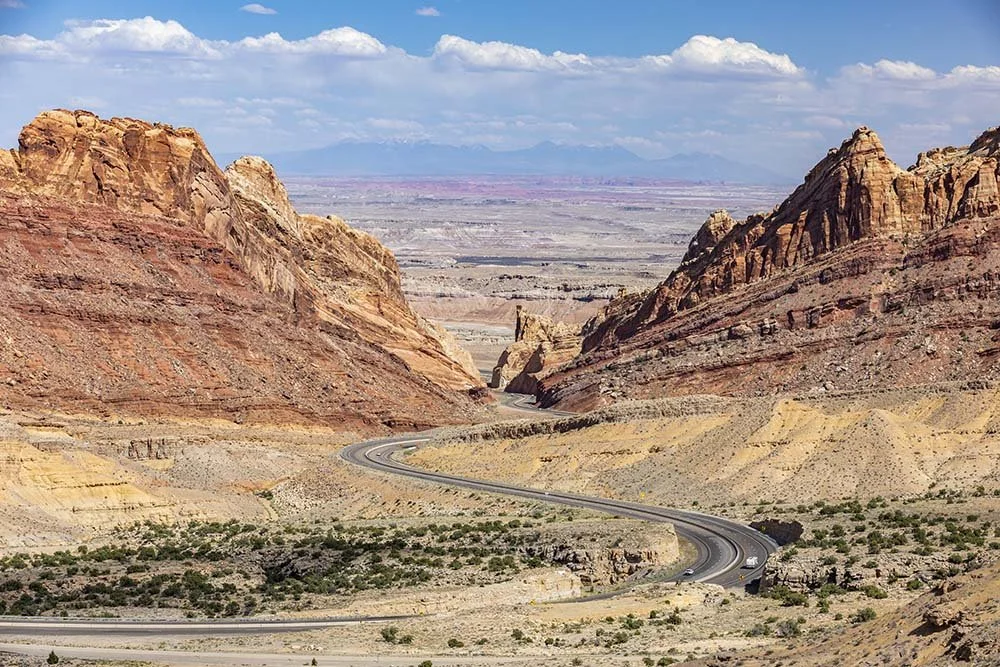
The San Rafael Swell is a massive geologic uplift in the middle of Emery County. How massive you ask? The Swell is 80 miles long and 35 miles wide, which is roughly 130,000 square miles. Formed over 50 million years ago, the San Rafael Swell, or “The Swell” as the locals call it, is as diverse as it is large. The northern edge of the Swell is designated as Jurassic National Monument, in honor of the world’s largest collection of Allosaurus fossils found there. A visit to Cleveland Lloyd Dinosaur Quarry will teach you about the ancient life that once dominated the landscape. In the center of the Swell you will find The Wedge, or Little Grand Canyon, a sight not to be missed, and along the Eastern Edge you will find the Reef, a reference to the dangerous edge of the swell that was a treacherous landmark to early settlers in the area.
Hidden throughout the Swell are signs of past native cultures that called this area home. Pre-Columbian artifacts have been found throughout the Swell, as well as a world renown collection of rock art attributed to the Fremont Culture.
From past inhabitants to current ones… the Swell is home to Utah’s largest herd of desert bighorn sheep, wild horses, burros, mountain lions and the fast and beautiful pronghorn antelope.
Over the past decade the popularity of the Swell as a destination for both solitude and adventure has grown exponentially. This has come with all the good and bad aspects to visitation. It is important to remember that while the environment looks rough and tumble ready, it is in fact a delicately balanced ecosystem. We ask that you treat this land with the respect that it deserves, staying in designated areas, packing out everything you pack in, and being respectful of those working the land, grazing cattle.


DISCOVER one of
the best basecamps
On the eastern edge of the County you will find the city of Green River. Green River is the Waypoint to Wild. Together with Moab, this city is one of the best basecamps for exploring the region's world renown state and national parks. The eastern part of the county is part of the greater Colorado Plateau, an expansive high desert that spans multiple states and has the greatest concentration of national parks in the Country.
The city of Green River is named after the river that runs through the city and offers great opportunities for river rafting, floating and lounging along the shore. To the north you will see the impressive Book Cliffs, named after the thick layer of sandstone that caps the cliffs that many think looks like books on a shelf. The Colorado Plateau extends all the way to the Grand Canyon, and offers a wide variety of adventures sure to energize you.