Rochester
Panel

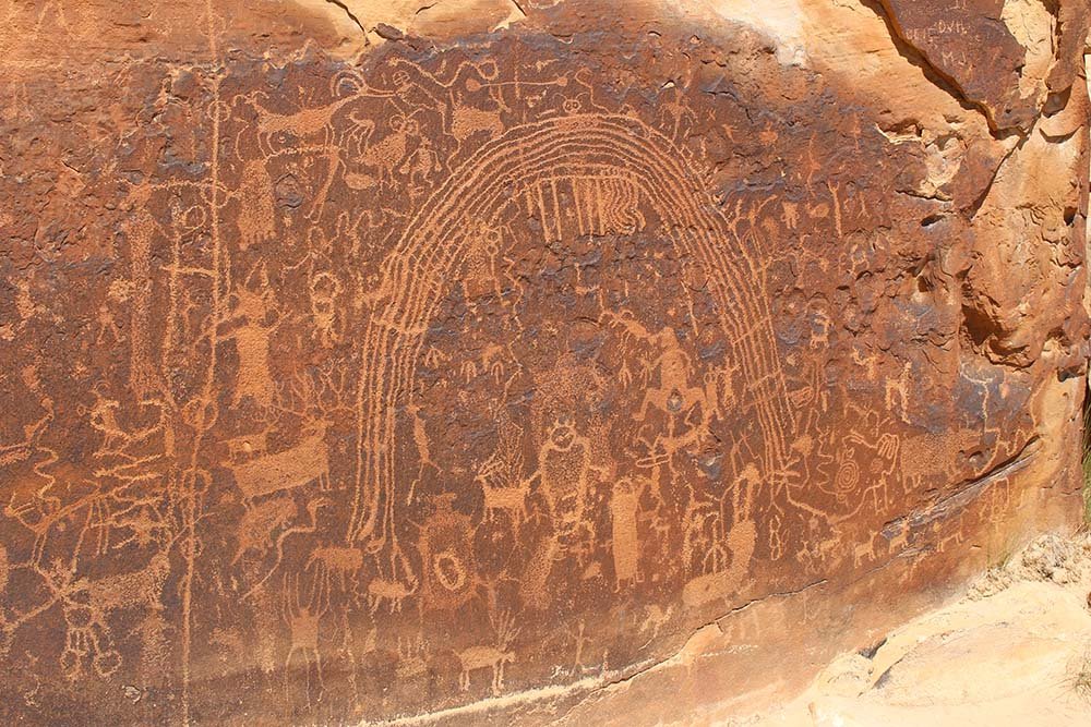
The Rochester Rock Art Panel dates back to at least 1300 AD and is one of the best examples of rock art from the Fremont Culture, a culture that included a wide range of ancient hunter-gatherer groups.
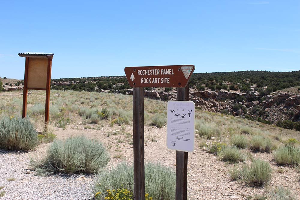
The panel is at the end of a well marked, easy hike along a branch of Muddy Creek. The popular hiking trail to the Rochester Panel is great for all ages and abilities. Though a little rocky and primitive, the trail to the petroglyphs is only a half mile with 80 feet of elevation gain. The trail ends upon joining the main branch of Muddy Creek, an ancient river course that predates the rise of the San Rafael uplift 40 to 60 million years ago.
The Native Americans thought to have made the panel were part of the Fremont Culture, which is thought to date back 2500 years and known throughout Utah (evidence of the population starts to disappear about a 1000 years ago). There are numerous archaeological sites around the Swell where artifacts have been excavated and studied in addition to the rock art they left behind.
The Rochester Panel feature several of the classic elements often portrayed in Fremont petroglyphs. However, though many rock art experts attribute this ancient petroglyph panel to the Fremont Culture, others believe it was created by the Barrier Canyon Culture, a hunter-gatherer society known to create rock art in Horseshoe and Sego Canyons. The panel includes common elements of Fremont culture art, such as anthropomorphs (human-like figures), concentric circles, rainbow arcs, and wavy lines. Though studied over the years by anthropologists, the meaning of the art is not known. To learn more about these studies, visit the Museum of the San Rafael.
From the parking lot, visitors can also strike off on mountain bikes or OHV/ATV on the dirt roads that fork off from the parking area.

activities


Seek


services
Please note there are no services available at this destination. There is parking and interpretive signage at the trailhead.
Location
Drive south from Ferron on highway 10. Continue passed milepost 17 and then turn east onto another road. Drive 0.5 miles passing the Rochester Panel sign and turn onto a well maintained graveled road. Continue driving another 4.1 miles to the trailhead. From here you’ll need to hike 0.5 miles (one way) on the trail just east of the parking lot to reach the panel.
ONLINE RESOURCES